BSBI Recorders
Lanarkshire is now part of the West Central Scotland Botany Network - follow the link to find out more!
Lanarkshire
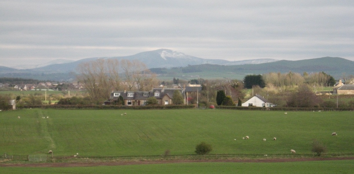
The vice-county of Lanarkshire is large, encompassing the current political entities of South Lanarkshire, North Lanarkshire, a large portion of the City of Glasgow and part of East Dunbartonshire. In total, this area involves 661 tetrads (2,459 sq. km).
The landscape has remote hills and high moorland in the south, upland and fertile lowland farm country, areas of former mining development (whose spoil-heaps, or ‘bings’ as they are locally called, provide much botanical interest), and the extensive urban sprawl of greater Glasgow.
Essentially it is all about the Clyde, formed from streams in the Lowther Hills, meandering across farmland from Biggar to Carstairs, plunging over the spectacular Falls of Clyde at Lanark, developing grandeur along the Clyde Valley, and becoming one of Scotland’s most celebrated and historic rivers through the centre of Glasgow. Along this major watercourse, many tributaries emerge from steep-sided valleys and gorges, which offer both challenges and rewards to the botanist.
Following the high level of recording seen in recent years, ensuring a thorough Lanarkshire record for the new Atlas 2020, we are looking forward to some new kinds of fieldwork activity.
We hope to undertake smaller local projects and species studies - as well as exploration of the still large number of remote monads in our vice-county which have never yet been recorded. This apparent lack of curiosity on our part is to some extent explained by the fact that, until quite recently, much of the recording in Lanarkshire was done at tetrad (and even at hectad) level.


Field meetings
*NEW* Our full programme of Renfrewshire, Lanarkshire and Dunbartonshire outings for 2025 can be found here: Outings Programme 2025 - full version.
The full programme of West Central Scotland Botany Network outings for 2024 can be viewed here.
Recording
Records of plants are welcome (at 1 km or 2 km square resolution, and higher, preferably 8-figure GR, for uncommon species) plus any notes, images and queries regarding these.


Lanarkshire Botany Newsletter
Click on links to view or download:
- Spring Newsletter 2024
- No. 24 Autumn 2023
- No. 23 Summer 2023
- No. 22 Spring 2023
- No. 21 Autumn 2022
- No. 20 Summer 2022
- No. 19 Spring 2022
- No. 18 Autumn 2021
- No. 17 Summer 2021
- No. 16 Spring 2021
- No. 15 November 2020
- No. 14 July 2020
- No. 13 February 2020
- No. 12 July 2019
- No. 11 May 2019
- No. 10 Spring 2019
- No. 9 New Year 2019
- No. 8 August 2018
- No. 7 May 2018
- No. 6 Spring 2018
- No. 5 New Year 2018
- No. 4 Summer 2017
- No. 3 June 2017
- No. 2 April 2017
- No. 1 Spring 2017