Stirlingshire Botany Group
Stirlingshire (vc86) and West Perthshire (vc87) have joined forces to develop an active local botany group, holding regular field meetings. To find out more email Matt Harding.
Here are some write ups from our recent outings:
About the Vice-county
Although one of the smaller vice counties (the 23rd smallest in Britain, measuring approximately 1250 square kilometres) the range of environment and plant habitat to be found here is nevertheless very broad. In spite of this and its proximity to Glasgow, Edinburgh and the central belt it is not over-recorded by local botanists and, perhaps because of the draw of the highland counties to travellers from the south, would-be visitors may overlook it as a botanical destination.
Stirling has historically been viewed as the 'Brooch of Scotland' and the analogy might be stretched to its botany. East and west and upland and lowland are clasped together across the country's narrow neck of the Forth-Clyde isthmus making something of a mixing zone for various geographic influences in her vegetation. The Highland Boundary fault bisects the county so that its northwestern part - about 15% of the whole - lies in the West Highlands (this loosely corresponds with the part of the vice county which falls within Loch Lomond & the Trossachs National Park). The vegetation ranges dramatically from the saltmarsh communities of the Forth estuary to the summit of Ben Lomond with its alpine interest and from the fertile lowland valleys of the Kelvin and Avon to the Campsie Fells and remnant raised bogs of the Forth valley carse. The western border of the county with Dunbartonshire is formed by the eastern shore of Loch Lomond with its chain of ancient semi-natural oceanic oakwoods and nationally important wetlands where the Scottish Dock, Rumex aquaticus, grows.
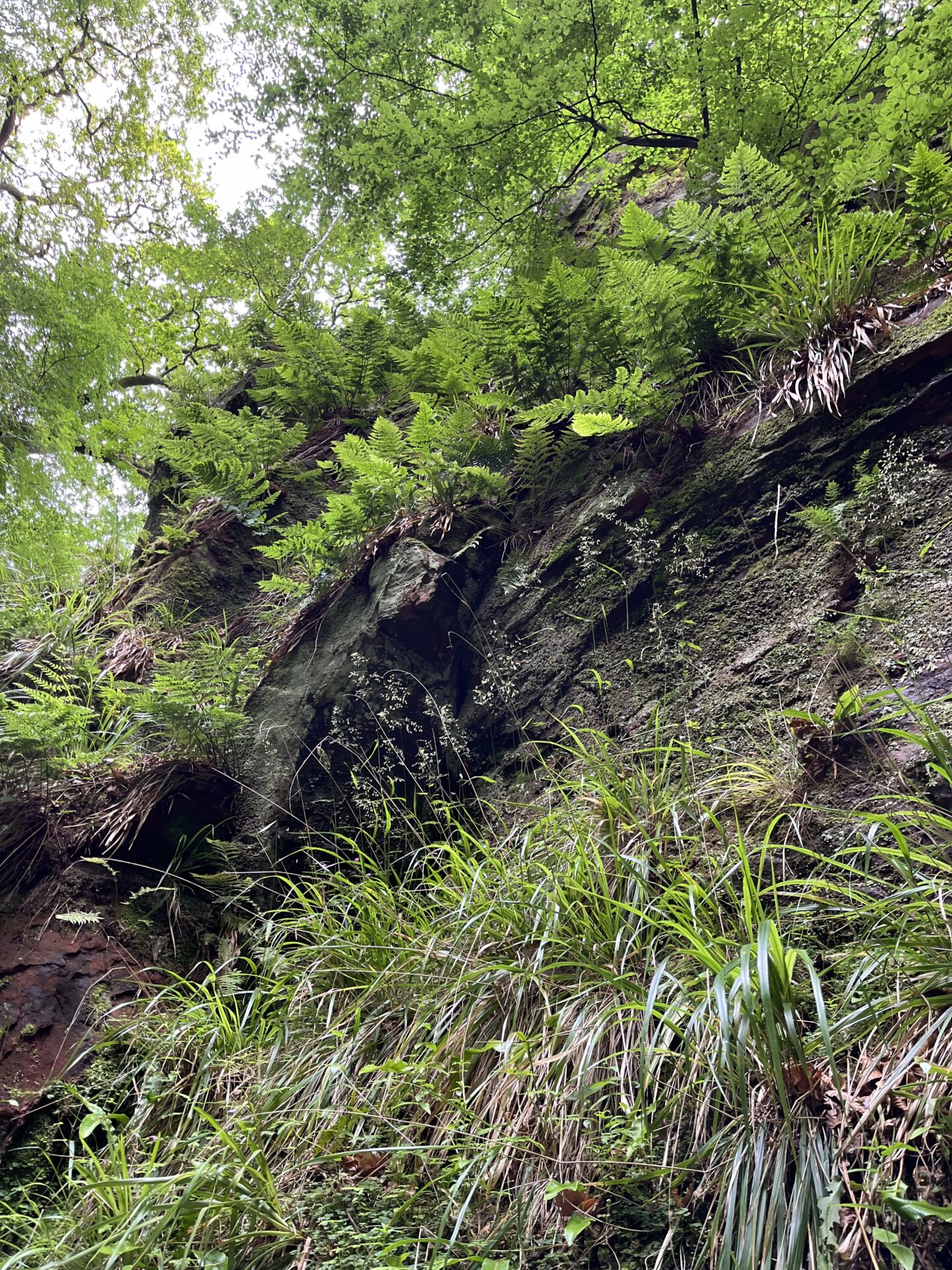
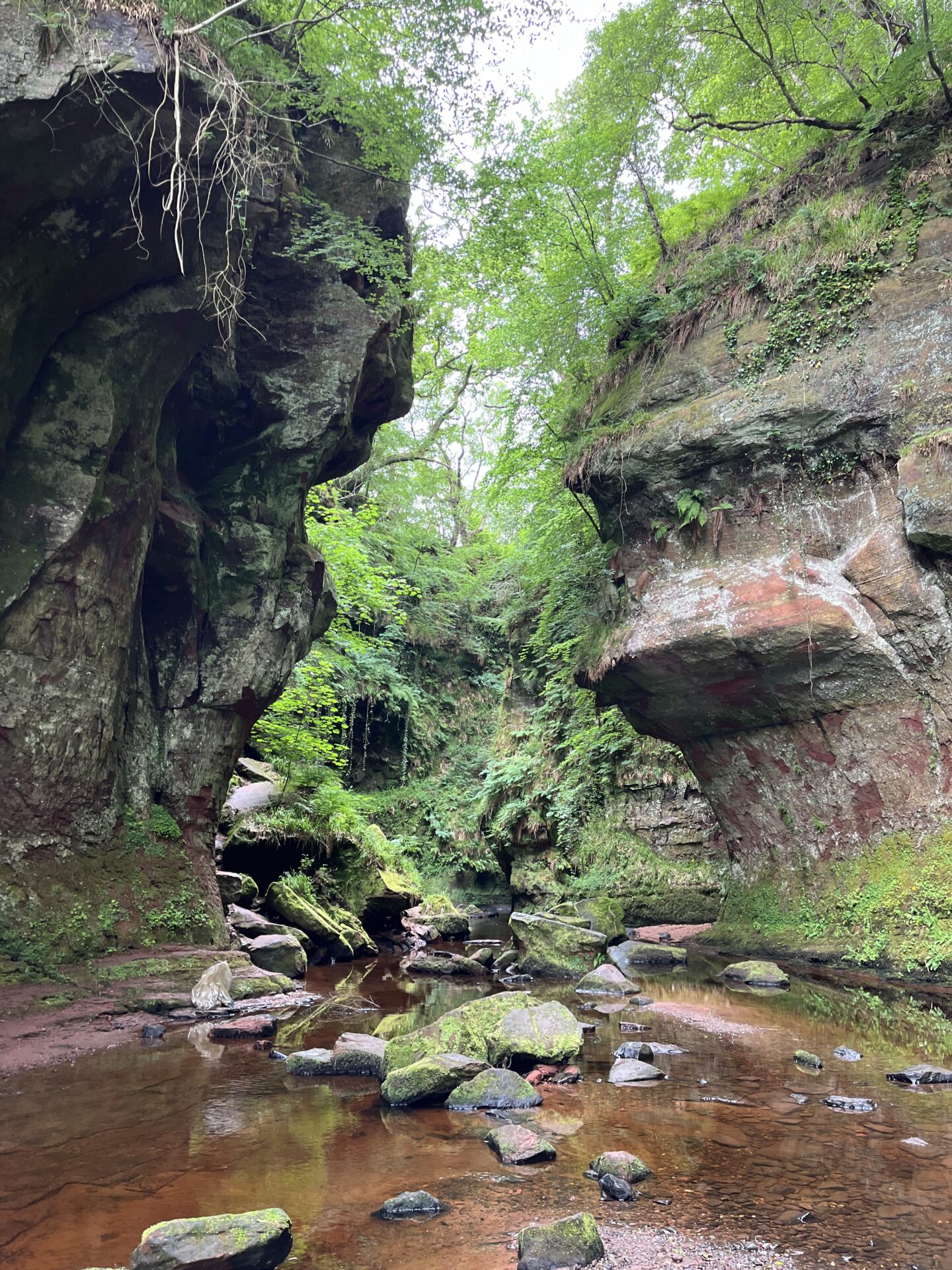
Whilst most of the county is technically lowland, the extensive plateau of the Campsie Fells and the associated Kilsyth and Touch Hills lies entirely within Stirlingshire and forms a core of high ground central to the county. These hills have dry escarpments north and south but large tracts of bogland in their interior on the dip slopes. The drainage of this basalt area forms numerous shallow gorges which are often botanically interesting and provide refugia for survivals of native woodland. Although the surrounding moors are often much degraded ecologically, they are under-explored and pockets of interesting vegetation persist containing, for example, outlying populations of montane species such as Rubus chamaemorus. Where the water courses raised on the plateau cut down through a belt of Devonian sandstone to the north and west they can sometimes become spectacularly canyon-like and hold interesting mosaics of calcifugous and calcicolous woodland communities.
The watersheds in these hills distribute the precipitation among the surrounding lowland valleys which are also important to the botanical character of the county - the Forth, Endrick, Carron and Kelvin. The remaining semi-natural vegetation in these straths is very varied with typically lowland or southern species often mingling intimately with upland or western species.
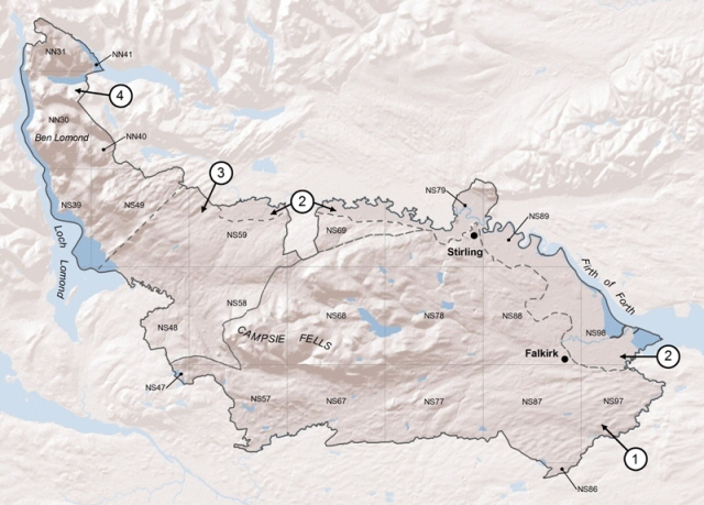
Map of Vice County 86 showing terrain, hectads and the botanical districts (broken line) used in Stirling and Kidston's papers on the flora of Stirlingshire. District boundaries based on an interpretation of Stirling and Kidston's (1892) text using modern geological maps: 1. Carboniferous; 2. 'Carse'; 3. Old Red Sandstone; 4. 'Highland'.
The Flora
No county Flora or Rare Plant Register has yet been produced for Stirlingshire.
In the late 19th century Col. J.S. Stirling and Robert Kidston FRSE published ten papers - based on their own fieldwork and careful verification of existing specimens - detailing the county's flora. A number of species had erroneously been claimed for Stirlingshire which were in fact Perthshire or Argyllshire plants found in 'political' rather than 'botanical' Stirlingshire or 'Glasgow plants' from the area south of the Kelvin. Stirling and Kidston did a good job of weeding these out and their checklist is still a useful resource, although of course the flora has changed. Similarly their division of the county into four districts based on the broad geological and topographical pattern of the county still provides a good framework for thinking about the distribution of plants in Stirlingshire (although other systems have been suggested including three districts based on the Forth, Loch Lomond and Kelvin drainage areas).
Unfortunately their sequence of papers, in which earlier work is successively amended and supplemented, has never been properly synthesised and reproduced. As an upcoming project we hope to digitise the whole and normalise taxon names to modern nomenclature; this will provide an accessible historical baseline for further study of the county's flora. In the meantime, the main (2nd) paper, which provided the backbone of the checklist, has been obtained and is available below as a pdf. Additionally some of the other parts have been digitised by Google.
Records and recording
The current priority for the BSBI in Stirlingshire is achieving adequate survey coverage for the forthcoming Atlas 2020. We encourage anyone botanising in the county (BSBI member or not) to contribute to this important project by submitting their records to the vice county recorders. A recording card can be downloaded here and further information about how and what to record, if required, is available in the Resources page. The fine detail of the vice county boundary can be inspected online at http://www.cucaera.co.uk. The minimum recording unit used by the BSBI is the tetrad (2km by 2km square). However, it is not necessary to survey a whole tetrad in order to make a worthwhile contribution; lists of species from smaller sites will be used for the Atlas. In fact we welcome monad, site or even quadrat resolution records because they are more meaningful in terms of the ecological and detailed distributional information they generate.
If you are able to type up your records before submitting them by email it is very helpful to the volunteers who manage the dataset (but do retain your original copies). This is the preferred method for sending data and means that the information can be incorporated into the local and national database relatively quickly. If this is not possible then do still please send your paper records (or good clear copies) and we will endeavour to digitise them.
In order to help focus recording effort in the remaining seasons before 2020 recorders may like to access and download lists of taxa known from each square showing which species have and have not yet been recorded for Atlas 2020 relative to the previous recording period (1987-1999).
This can be done as follows:
Go to the Grid reference lookup tool on the DDb website: https://database.bsbi.org/
On this screen enter and search for a 10km or 2km grid square (e.g. NS88 or NS88M) then click ‘View taxon list’ (species with recent records will appear in bold) and then choose to 'sort recent records separately'.
This can be helpful for checking on what you might expect to find, seeing if you've found something new or for targeting species which haven't been recorded for a while.
These are not intended as 'hit lists' - general and inclusive botanical surveying is still the key requirement - but can help with targeting under-recorded habitats or species groups which particularly need attention. The lists can also be used to quickly check for common species which have not recently been recorded in a given hectad and which might be relatively easily found (Please don't assume that somebody else will record common species in your area - these records can make a really useful contribution to the Atlas 2020 effort!)
Further reading
- Mitchell, J. (2001). Loch Lomondside. New Naturalist. No.88. Harper Collins, London.
- Stirling, J.S. & Kidston, R. (1891). Notes on the flora of the western portion of Stirlingshire. Transactions of the Stirling Natural History and Archaeological Society 1890/91, 88-102.
- Stirling, J.S. & Kidston, R. (1892). Notes on the flora of Stirlingshire. Transactions of the Stirling Natural History and Archaeological Society 1891/92, 74-102. pdf: scanned from a reprint by BSBI
- Stirling, J.S. & Kidston, R. (1893). Notes on the flora of Stirlingshire. Transactions of the Stirling Natural History and Archaeological Society 1892/93, 109-113. pdf: digitised by Google
- Stirling, J.S. & Kidston, R. (1894). Notes on the flora of Stirlingshire. Transactions of the Stirling Natural History and Archaeological Society 1893/94, 88-92. pdf: digitised by Google
- Stirling, J.S. & Kidston, R. (1895). Notes on the flora of Stirlingshire. Transactions of the Stirling Natural History and Archaeological Society 1894/95, 80-86. pdf: digitised by Google
- Stirling, J.S. & Kidston, R. (1896). Notes on the flora of Stirlingshire. Transactions of the Stirling Natural History and Archaeological Society 1895/96, 137-139.
- Stirling, J.S. & Kidston, R. (1897). Notes on the flora of Stirlingshire. Transactions of the Stirling Natural History and Archaeological Society 1896/97, 103-106.
- Stirling, J.S. & Kidston, R. (1898). Notes on the flora of Stirlingshire. Transactions of the Stirling Natural History and Archaeological Society 1897/98, 134-135.
- Stirling, J.S. & Kidston, R. (1899). Notes on the flora of Stirlingshire. Transactions of the Stirling Natural History and Archaeological Society 1898/99, 166.
- Stirling, J.S. & Kidston, R. (1900). Notes on the flora of Stirlingshire. Transactions of the Stirling Natural History and Archaeological Society 1899/1900, 67.
- For other botanical literature relating to Stirlingshire see Simpson's Bibliographic Index to the British Flora.
The journals Forth Naturalist and Historian and The Glasgow Naturalist publish papers on the natural history, including plant life, of the area.
County Recorders
Rare Plant Register
The first Rare Plant Register for Stirlingshire is in prep, and available to view as a draft list, updated to the end of 2024.
